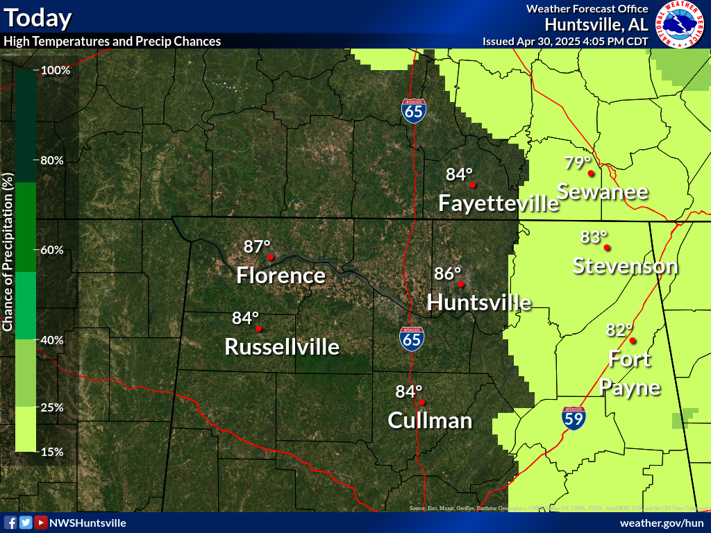
A return of moisture from the Gulf, along with higher instability from daytime heating, will bring low chances (20-30%) for showers and thunderstorms across parts of the Tennessee Valley this afternoon. Rain chances will increase as we go into the mid and latter portions of the week. Some of the thunderstorms Thursday into Friday could become strong to severe in intensity. A cold front is forecast to sweep across the area Friday, ushering drier and cooler air to the area for the upcoming weekend. High temperatures today into Thursday should warm into the low/mid 80s, then in the 70s Friday and Saturday. Lows in the 60s tonight through Thursday night will cool into the 40s and 50s Friday and Saturday nights.


 Local Radar
 Weather Map